North Meath
Kells-Oldcastle-Loughcrew-Castlekiernan
There are forest parks at Lough Sheelin and at Lough Bracken
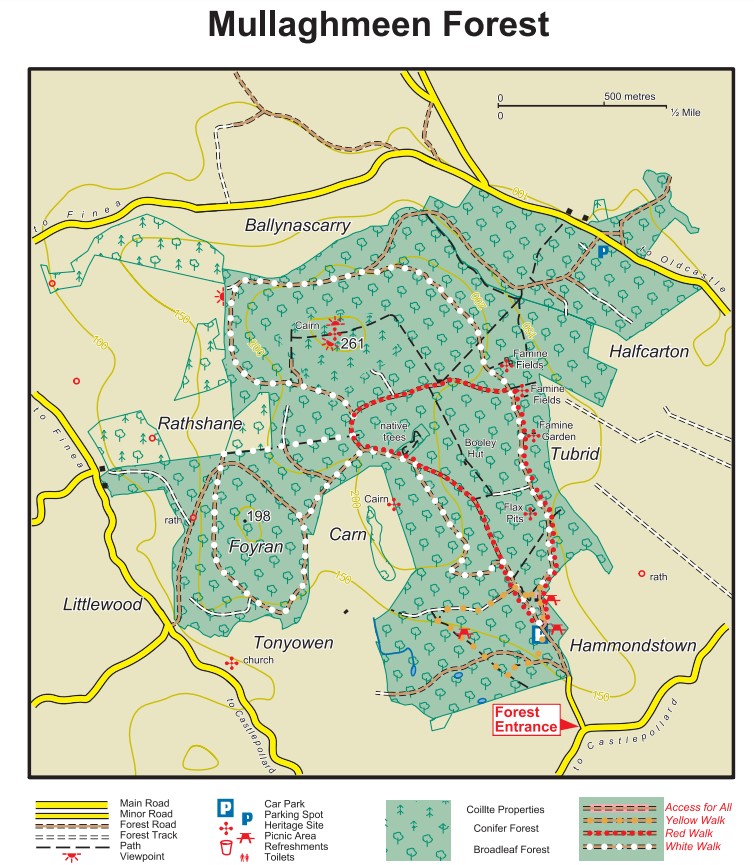
Forest Walk - Mullaghmeen Forest
Originally the land was part of Lord Buckinghamshire's Irish Estate. Later , Mullaghmeen became the property of Lord Gradwell of Dowth hall in County Meath and was run as a farm. In the 1930's, the Department of Agriculture acquired Mullaghmeen forest and planted deciduous trees on the limestone rich soil.
Mullaghmeen Forest is a state forest and provides 14 miles of roadway for the walker. It leads to the highest point in Westmeath (894ft.)
Click here for a downloadable map
How to get there
Mullaghmeen Forest is 9km from Castlepollard and 10km from Oldcastle.
From Castlepollard, drive out Water Street past the National and VEC schools and stay on this road. There are a few sharp turns and one sharp Y junction turn where the left fork should be taken (it is signposted for the forest but easy to miss) but basically stay on the same road until you come to the main entrance to the forest (which is signposted) on the left.
From Oldcastle, take the Castlepollard road past Millbrook to the first Y junction where a right turn off the main road should be taken. Follow this road until you pass Briody Holdings on the right and take a left turn
immediately after this shop. The forest is on this road so keep driving until the main entrance gate is seen on the right.